iAspirants
Current AffairsPrelims PYQsUPSC CSE SyllabusUPSC CSE StrategyBlogsPricing
Login
iAspirants

Your AI-powered companion for UPSC preparation.

Quick Links

  • Home
  • About Us
  • Current Affairs
  • Prelims PYQs
  • UPSC CSE Syllabus
  • UPSC CSE Strategy
  • Blogs

Company

  • Pricing
  • FAQs
  • Contact Us
  • Login

Legal

  • Privacy Policy
  • Terms & Conditions
  • Return Policy

© 2025 iAspirants, Inc. All rights reserved.

  1. Blogs
  2. Indian and World Geography

Historical Landscape of Rayalaseema

Published on: 17-Oct-2026

Source: The Hindu

Share this post

Historical Landscape of Rayalaseema

Article Summary

Geological and Historical Significance of Rayalaseema, Andhra Pradesh

  1. Geological Overview:

    • Rayalaseema is part of the ancient Dharwar Craton and Cuddapah Basin, with geological formations over 2.5 billion years old.
    • Rich in geological features like the Eparchaean Unconformity, representing key historical shifts in Earth's geology, showcasing a billion-year gap in Earth's history.
  2. Key Geological Features:

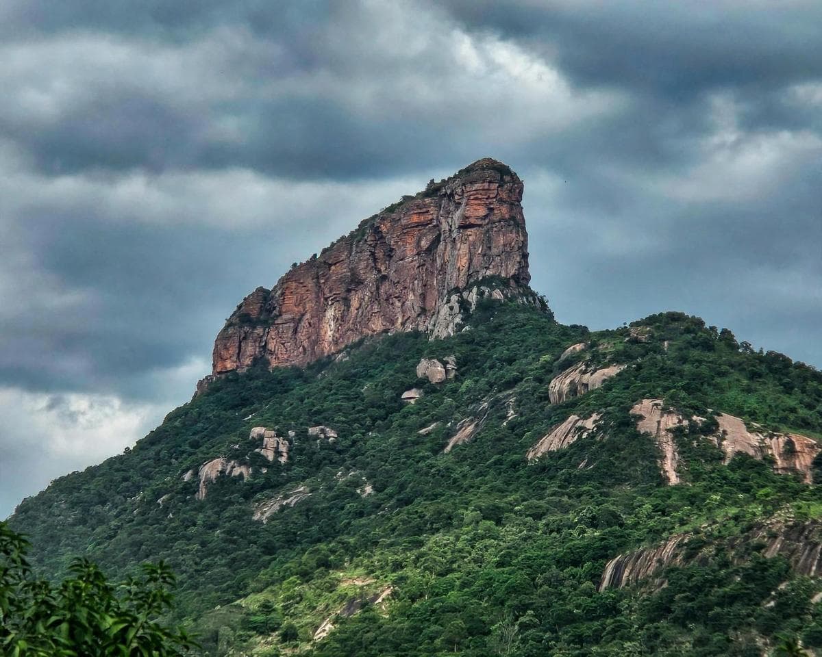
    • Nagari Hills: Formed 1.5 billion years ago, these hills comprise ultra-hard quartzite and granite, strategically important during historical conflicts.
    • Moghili Ghat: Dating about three billion years, obliterated for highway construction, exemplifying threats to geological formations.
  3. Environmental and Biodiversity Issues:

    • The region hosts unique flora and fauna, e.g., the Red Sanders tree and the endangered Jerdon’s Courser, adapted to the harsh, mineral-rich environments.
    • The Golden Gecko is restricted to Seshachalam Hills, demonstrating the region's ecological uniqueness.
  4. Impact of Human Activities:

    • Unregulated quarrying, construction, and tourism threaten geological structures and biodiversity.
    • Instances of significant geological formations being compromised for infrastructure, such as road expansions and quarrying operations leading to irreversible damage.
  5. Cultural and Religious Significance:

    • Sites like the Yaganti temple amalgamate geological formations with cultural heritage, showcasing the intersection of natural and human history.
    • Traditional practices continue to validate the spiritual significance of sites, e.g., pujas performed atop Nagari Nose.
  6. Conservation Efforts and Proposals:

    • Demand for UNESCO Global Geopark status to protect geological sites while promoting responsible tourism and heritage education.
    • Proposals include establishing regulated tourist zones and educational initiatives to enhance the understanding and appreciation of unique geological features.
  7. Judicial/Policy Advocacy:

    • Recommendations for government and officials to recognize the geological importance and take action to preserve these irreplaceable sites against industrial and urban encroachment.
  8. Scientific Research:

    • Contribution to geological science through ongoing studies by local universities, highlighting the region’s role in understanding Earth's history and structure.
    • Suggestions for employing scientific insights into developing strategies for sustainable tourism and conservation.
  9. Future Directions:

    • The integration of conservation with modern developmental strategies is critical; perspectives encourage a balanced approach toward development, conservation, and education.
    • Urgent call for stakeholder involvement, including local communities, government, and scientific bodies, to collaboratively manage the region's ecological and historical wealth.
  10. Economics and Society:

    • The potential for heritage tourism to positively impact local economies while ensuring the protection of both cultural and natural resources.
    • Addressing human-wildlife conflicts resulting from habitat disruption caused by infrastructural development.

These points underscore the critical need for preserving Rayalaseema's intricate geological and cultural tapestry amid modernization, which threatens its unique heritage and ecological richness.

Key Terms & Concepts

Cuddapah BasinAncient geological formation
Dharwar CratonOldest crustal block in India
Nagari quartzite1.5 billion years old rock
Eparchaean UnconformitySignificant geological boundary
Belum CavesIndia's longest cave system
Golden GeckoRare lizard species
Jerdon’s CourserCritically endangered bird species
SilathoranamNatural rock arch formation
UNESCO Global GeoparkProposed protection status
Talakona FallsWaterfall formed by ancient rocks
Kailasakona FallsWaterfall in ancient rock formation
Ramanuja ChalapathiCommunity activist for preservation
Sri Venkateswara University

Mind Map for UPSC Civil Services Revision

Turn UPSC Civil Services Current Affairs Into Exam-Ready Notes

Reading Indian and World Geography current affairs is half the work. Revise them with ready-made notes and test what actually stuck.

  • Daily UPSC Civil Services current affairs analysis
  • Revision notes, mind maps & MCQs
  • Prelims mock tests with instant results

Related UPSC Civil Services Current Affairs Articles

Understanding the Importance of Isthmus
Indian and World Geography07-Jun-2026

Understanding the Importance of Isthmus

Exam-Focused Notes on the Panama Canal

Geographic and Historical Context

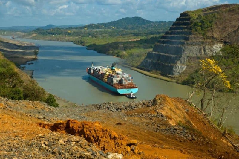
  • Isthmus Definition: A narrow strip of land connecting two larger landmasses, surrounded by water on both sides. Example: Isthmus of Panama (77 km long).
  • : Historical migratory events facilitated by the Isthmus of Panama.
Institution conducting geological research
Geological Survey of IndiaAuthority for geo-heritage site designation
Great American Biotic Interchange (GABI)

Engineering and Construction

  • Panama Canal: Initiated in 1903, revolutionized global shipping since its opening on August 15, 1914.
  • Ferdinand de Lesseps: French engineer behind the initial Suez Canal, later attempted Panama Canal but failed.
  • Adolphe Godin de Lepinay: Proposed a lock-based canal system, which the U.S. ultimately adopted.
  • Construction Challenges: Tropical diseases like yellow fever and malaria, harsh working conditions resulted in significant mortality during construction.

U.S. Involvement and Legal Framework

  • Treaty: Hay–Bunau-Varilla Treaty (November 18, 1903) allowed U.S. construction and control of the canal.
  • Theodore Roosevelt: Recognized as the "father of the Panama Canal.” Key accomplishments include the establishment of the Panama Canal Zone and acquisition of French assets.

Operational Milestones

  • First Passage: The first ocean-going vessel (S.S. Ancon) transited the canal on August 15, 1914.
  • Control Timeline:
    • 1914-1979: Exclusively U.S. controlled.
    • 1979-1999: Shared control.
    • Post-1999: Full control reverted to Panama.

Economic Significance

  • Over 1 million vessels have transited since 1914, averaging 10 hours for crossing.
  • Trade Efficiency: Savings of up to 15,000 km for vessels traveling from U.S. east to west coasts, versus circumventing South America via Cape Horn.
  • Current operational capacity strained, leading to increased tariffs and wait times due to rising traffic linked to geopolitical tensions (e.g., disruptions in the Strait of Hormuz).

Strategic Importance

  • The Panama Canal is pivotal for international trade, especially given the current geopolitical climate and its impact on global shipping routes.

Environmental Considerations

  • Highlighted the importance of managing tropical diseases during construction.

Summary

The Panama Canal represents a monumental achievement in engineering, impacting global trade routes since its completion. The U.S. involvement not only reflects historical geopolitical maneuvers but also significant diplomatic agreements that shaped Panama's autonomy and trade capabilities. The canal continues to play a crucial role in international shipping and economic efficiency.

Discovery of Aguada Fénix in Mexico
Indian and World Geography24-Nov-2025

Discovery of Aguada Fénix in Mexico

Summary of Key Findings on Aguada Fénix Archaeological Site

  • Location: Aguada Fénix, situated in Tabasco state, Mexico's Gulf Coast.

  • Historical Significance:

    • Estimated to be 3,000 years old.
    • Believed to represent a cosmogram—a geometric representation of the universe by early Maya societies.
  • Structural Details:

    • Features a large cruciform (cross-shaped pit) that is part of several interconnected structures linked by canals.
    • The total volume of these structures exceeds 3.8 million cubic metres, comparable to over 1,500 Olympic swimming pools or nearly one-and-a-half Pyramids of Giza.
  • Research Methodology:

    • Discovered using Airborne Laser Scanning (LiDAR) by a research team from the University of Arizona.
  • Color Symbolism:

    • Pigments corresponding to the four cardinal directions:
      • North: Bright blue azurite
      • South: Yellow ochre
      • East: Green malachite
      • West: Pearly seashells
    • These findings are considered the oldest known examples of directional color symbolism in Mesoamerica.
  • Cultural Insights:

    • The structure reflects a non-hierarchical society with no evidence found of palaces, tombs, or centralized authority.
    • Suggests communal effort in construction involving at least 1,000 workers over several years, emphasizing cooperative society dynamics.
  • Archaeological Findings:

    • Jade sculptures primarily depict animals, with one representation suggesting a woman giving birth.
    • These artifacts indicate that themes of natural events and everyday life were more prominent than glorification of deities or rulers.
  • Implications for Social Understanding:

    • Aguada Fénix may provide insights on social equality and communal practices among early Mesoamerican societies.
    • Future excavations may deepen understanding of socio-economic disparities and cultural practices of its builders.
  • Publication Reference: New research findings are documented in the journal "Science Advances."

  • Expert Commentary:

    • Dr. James A Doyle (independent Maya specialist) emphasizes the importance of studying these structures to understand the organization and governance of early Maya societies.

This summary encapsulates significant archaeological insights into the Aguada Fénix site, relevant not only for historical and cultural studies but also for understanding the social dynamics of one of the earliest Maya civilizations.