iAspirants
Historical Mapping of Tamil Coast
Published on:
Share this post
Article Summary
The article explores the historical significance of cartography and its evolution in the Tamil coastal region during the period of European colonial expansion. It highlights how European powers such as the Portuguese, Dutch, Danes, English, and French contributed to the development of maps and geographical knowledge of the Tamil coast, impacting trade, maritime navigation, and missionary endeavors.
Summary:
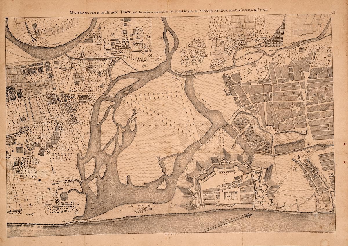
European Arrival and Cartography: European traders and missionaries, starting from the arrival of the Portuguese in the 15th century, played a crucial role in cartographic development in the Tamil region. They established forts and settlements, notably differentiating between European-managed areas (White Town) and local settlements (Black Town).
Maps as Strategic Tools: The preparation of coastal maps and charts was strategic, meant to ensure safe navigation for European ships while also protecting information from rival trading companies. These maps detailed water depths and hazards, assisting sea captains and pilots in traversing the region.
Sophistication in Geography: The European exploration and colonization led to increased sophistication in obtaining geographic information about the Tamil coast. For example, Portuguese sailors developed maps that highlighted alternative sailing routes based on varying weather conditions.
Cultural Exchange: The maps facilitated a cultural and geographic exchange between the Tamil region and Europe, making the region better known in Europe alongside the spread of Christian missions.
Key Cartographic Contributions:
- Devanampattinam (1607)
- Nagapattinam Maps (1635-58)
- Santhome of Mylapore Maps (1635-87)
- Topographical Map of Santhome (1749)
- Maps of Fort Dansborg in Tranquebar (1669-71)
Archival Locations: Significant cartographic records are stored in various international archives:
- Centre for History and Old Cartography, Lisbon (Portugal)
- Royal Library, Copenhagen (Denmark)
- National Archives, The Hague (Netherlands)
- Overseas Archival Centre, Aix-en-Provence (France)
- Tamil Nadu State Archives, Chennai (India)
Military Maps and Revenue Surveys: The Anglo-French struggle during the Carnatic Wars (1746-1761) spurred the creation of detailed maps related to military actions. The British East India Company's land revenue surveys from 1767-1857 led to systematic mapping of the Tamil landscape.
Digital Preservation of Historical Data: In a modern effort to preserve historical records, the Tamil Nadu State Archives has digitalized and uploaded maps related to forts and military installations, making them accessible to historians and researchers.
Ongoing Research Dynamics: The field of colonial history is evolving, influenced by ongoing maritime trade, missionary activities, and changes in military and territorial governance. New perspectives are continually emerging that reshape the understanding of colonialism through cartographic insights.
Important Points:
- The article highlights the role of European powers in cartographic developments along the Tamil coast.
- It emphasizes the strategic importance of maps in trade, navigation, and military planning.
- Various archival locations preserve vital historical cartographic documents.
- The article notes advancements in digitalization that enhance accessibility to historical maps for researchers.
- Ongoing research continues to bring forth new perspectives on colonial history influenced by trade, military expansion, and technology.
Published on September 12, 2025, the article serves as a significant resource for understanding the interplay between geography, commerce, and colonial history in Tamil Nadu.
Key Terms & Concepts
| Portuguese colony of Devanampattinam | Historical map of region |
| Centre for History and Old Cartography | Location of historical maps |
| Royal Library, Copenhagen | Holds historical maps |
| National Archives, The Hague | Repository of maps |
| Tamil Nadu State Archives | Significant archival collection |
| Tamil Digital Library | Digitalization of maps |