iAspirants
Landslide Threatens Arunachal Pradesh Infrastructure
Published on:
Share this post
Article Summary
Key Highlights from Landslide and Flood Incident in Arunachal Pradesh, June 2026
Geographical Impact:
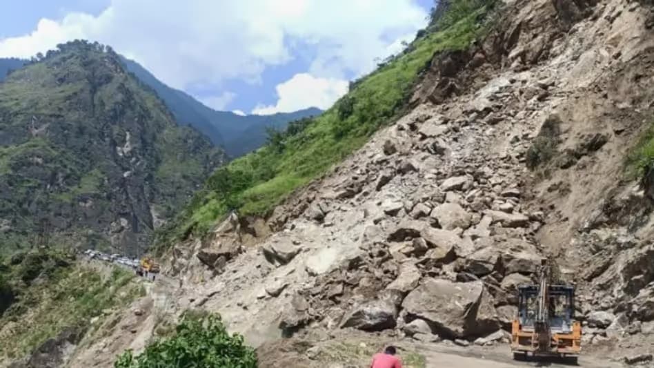
- A significant landslide occurred in Lower Siang district, Arunachal Pradesh, caused by torrential rainfall, resulting in the Siji river being blocked.
- The landslide created an artificial lake above Likabali town, raising concerns about a potential flash flood downstream.
Alert and Evacuation Measures:
- District authorities alerted residents in Likabali and along the Siji river, advising vigilance and preparedness for possible evacuation.
- Recommendations included staying away from riverbanks and reporting any unusual observations regarding water level or dam stability to administrative authorities.
Affected Areas:
- In Assam, four revenue circles were impacted: Jonai, Sissiborgaon, Dhemaji, and Gogamukh.
- Approximately 15,483 people from 69 villages experienced flooding-related issues.
Infrastructure Damage:
- Infrastructure significantly affected includes:
- Collapse of a railway bridge across the Simen river.
- An iron bridge washed away.
- Erosion along National Highway 52.
- Rescue operations were launched for three missing persons in Keyi Panyor district, with two bodies recovered.
- Infrastructure significantly affected includes:
Restoration Efforts:
- The Border Roads Organisation restored the Kimin-Potin Road within 36 hours post-disruption caused by landslides and floods.
- This road serves as a crucial lifeline, impacting connectivity for five districts in higher elevation areas.
Flood Risks:
- The authorities anticipate a severe threat of flash flooding if the debris dam breaks, which poses risks to lives, homes, and public infrastructure.
Current Conditions:
- The region experienced incessant rainfall leading to multiple landslides and severe breaches over a 45-km stretch of road, with significant debris accumulation.
Recommendations for Residents:
- Residents are urged to comply with evacuation directives and remain alert regarding potential natural hazards due to heavy rainfall and the compromised riverbanks.
Key Takeaways:
- The incident underscores the vulnerability of infrastructure to extreme weather events and the necessity for effective disaster management protocols.
- Government and rescue efforts highlight the importance of rapid response in the face of natural calamities for mitigating human casualties and infrastructure losses.
This summary is crucial for understanding disaster management responses, infrastructural vulnerabilities, and the impacts of extreme weather events in Northeast India.
Key Terms & Concepts
| Siji river | Blocked by landslide |
| Siji-Magi Block Point | Location of debris dam |
| Likabali town | Downstream affected area |
| Gai river | Siji river downstream name |
| Dhemaji district | Affected by flood |
| National Highway 52 | Critical arterial route |
| 15,483 people | Affected flood victims |
| 69 villages | Flood-affected locations |
| June 24, 2026 | Date of flash flood event |
| Kimin-Potin Road | Restored critical route |
| 45-km stretch | Affected road section |
| Border Roads Organisation | Road restoration agency |