iAspirants
New Detailed Map of Antarctica's Terrain
Published on:
Share this post
Article Summary
Summary of Research on Antarctica's Subglacial Terrain
Key Findings:
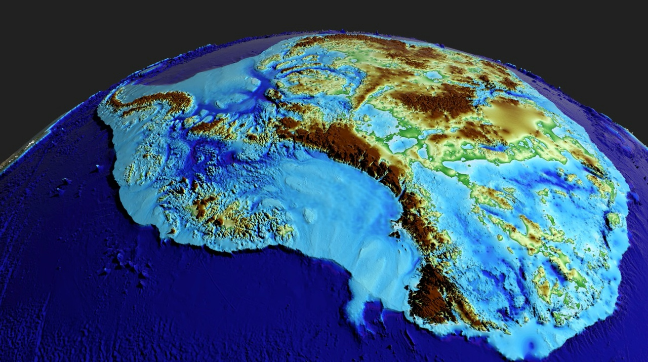
- Detailed Mapping: Researchers created the most comprehensive map of Antarctica's subglacial terrain, identifying over 30,000 previously uncharted hills (≥165 ft or 50 m).
- Terrain Features: The map revealed mountains, canyons, valleys, and plains below the ice, showcasing a diverse topographical landscape.
- Significance: Improved understanding of the subglacial bedrock is critical for modeling the ice sheet's response to climate change, particularly its contribution to sea-level rise.
Scientific Methodology:
- Mapping Technique: Utilized high-resolution satellite observations combined with a technique known as ice-flow perturbation analysis to estimate the conditions underneath the ice based on surface characteristics.
Comparative Data:
- Antarctica’s Size: Approximately 40% larger than Europe, 50% larger than the U.S., and half the area of Africa.
- Ice Thickness: Average ice thickness is about 1.3 miles (2.1 km), with maximum regions reaching 3 miles (4.8 km).
Historical Context:
- Geological Background: Antarctica initially sculpted before its ice coverage began over 34 million years ago. It was once connected to South America, which changed due to plate tectonics.
Environmental Impact:
- Global Freshwater: Antarctica holds about 70% of Earth's freshwater.
- Climate Forecasting: Findings are important for improving predictions related to climate change-related ice melting and its global sea-level impacts, potentially aiding in IPCC (Intergovernmental Panel on Climate Change) forecasts.
Advancements in Research:
- Previous Mapping Limits: Subglacial terrain was less thoroughly mapped than that of Mars; older methods had sampling gaps of 5 km to 150 km.
- New Insights: The new approach provides a holistic understanding of how various subglacial features are interconnected across Antarctica.
Future Directions:
- Field Surveys: The map not only assists in future climate modeling but also identifies areas where more detailed field surveys are necessary.
Conclusion:
This groundbreaking research sheds light on Antarctica's hidden geography and emphasizes the importance of understanding the continent's dynamics in the context of global climate change.
Key Terms & Concepts
| Antarctic Ice Sheet | Largest mass of ice |
| 70% | Percentage of freshwater on Earth |
| 1.3 miles (2.1 km) | Average thickness of ice |
| 3 miles (4.8 km) | Maximum thickness of ice |
| 34 million years ago | Time of ice covering formation |
| 30,000 | Previously uncharted hills identified |
| IPCC | Provides data for climate policies |
| ice-flow perturbation analysis | Method used for mapping |